

Why do you need offline maps?
Because some stretches genuinely have no signal. Crossing the Pyrenees, passing through tiny villages on the Meseta, or walking forest paths in Galicia can all mean spotty reception—and your international roaming data may not be enough to cover the whole trip.
What gets downloaded?
Only the area covered by your itinerary. Offline maps are tied to your specific trip and include:
- Base maps along your route
- The route track
- Town locations
- Lodging and landmarks
- Elevation data
How do you download them?
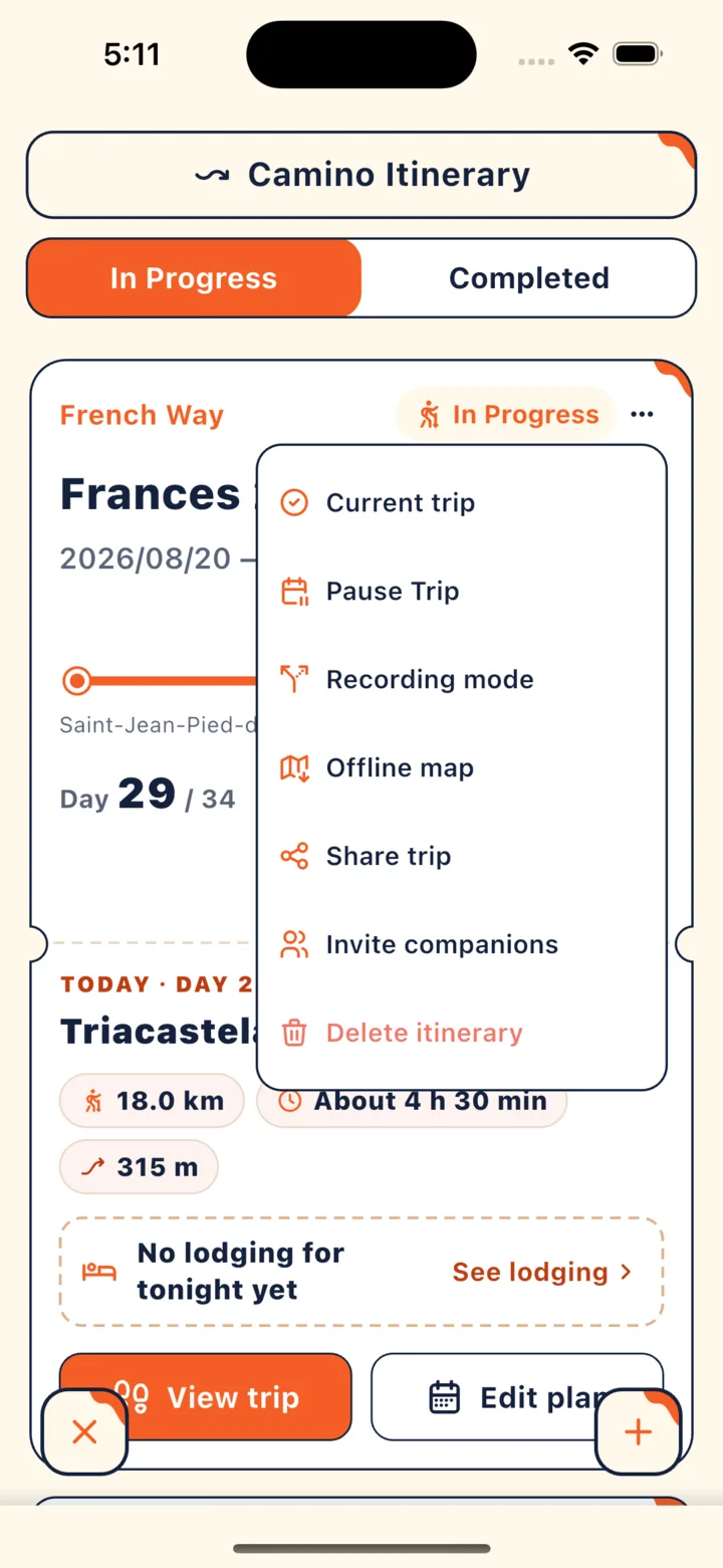
From the trip menu in “Camino Itinerary”.
- Open “Camino Itinerary” from the main menu and find your trip.
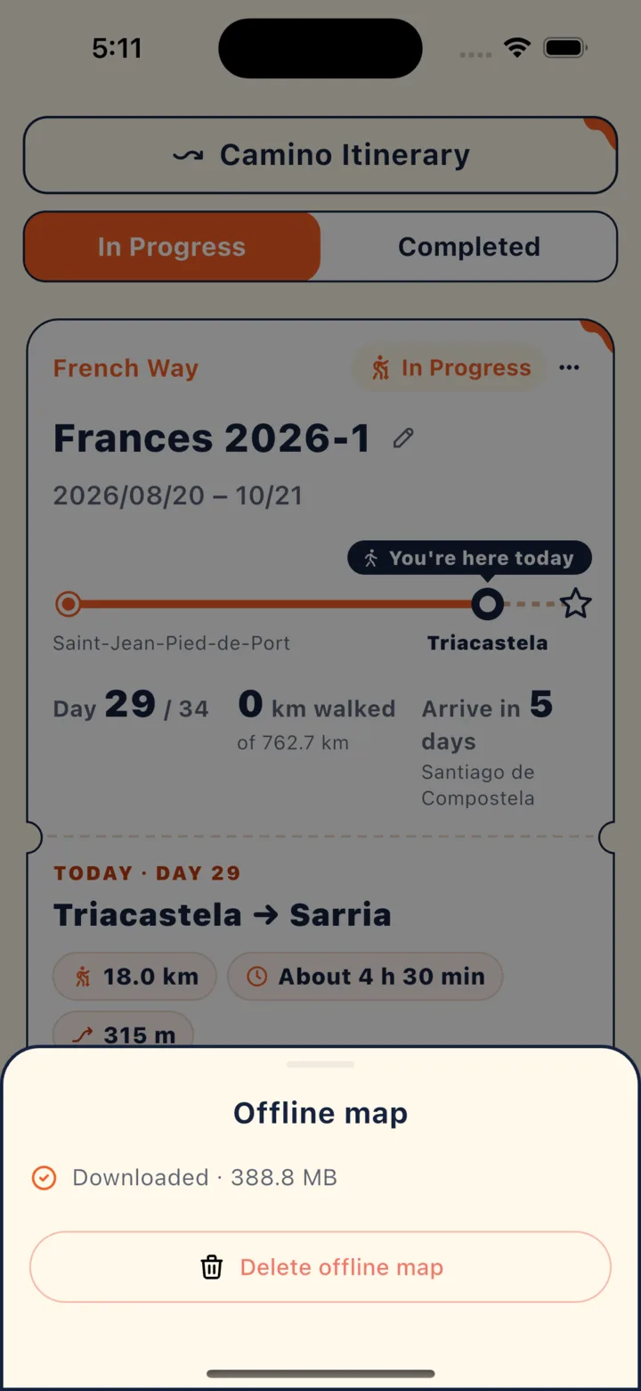
- Tap “⋯” in the top-right corner of the trip card and select “Offline map”.
- Tap “Download” to start and watch the progress on screen.
- Once you see “Downloaded” and the file size, you’re all set.
What should you keep in mind after downloading?
- If it shows “Still missing” for some items: The base map is ready, but a few details didn’t finish downloading. Once you’re back online, tap “Retry missing items”.
- After changing your route: The app will show “Route changed — re-download needed”. Remember to tap “Update”.
- When you no longer need it: You can delete the offline map for that trip from the exact same menu to free up space on your phone.
Which features need a connection when you’re offline?
Viewing the map works offline; actions that send or fetch data need a connection. You can view your downloaded maps, route, lodging, and landmarks without service. Asking the AI, browsing the community, editing and saving your itinerary, or booking rooms all require internet—the app will show “Offline — this needs a connection”, so just wait until you have signal again.
Is an offline map all you need?
You still need to watch the waymarks and the weather. The trail is designed for daytime walking, and authorities in Galicia also advise against walking at night. In an emergency, call 112.
Key points
- Download the night before you start, while you’re on Wi-Fi.
- Included in the download: base maps, route, towns, lodging and landmarks, and elevation data.
- Tap “Update” whenever you change your route.
In CaminoGO
Next, check out Planning your stages and changing plans along the way and Walk tracking and the Stamp Book.
Sources
- CaminoGO 客服支援(使用上的問題) (checked 2026-10-16)
- 加利西亞官方聖雅各之路網站:Advice and recommendations (checked 2026-10-16)
Walk it with CaminoGO
Offline maps, a plan that fits your pace, changes on the way, and a daily walk log with passport stamps — all in the app.
Get the app